Wildfire Aerial Operations
Aerial wildfire suppression and heavy-lift rescue, delivered where crews can’t reach.
Wildfire Response
- Extreme scale and spread
Under aligned winds, slopes, and fuels, fires can outrun ground crews, making it difficult to keep line construction ahead of the flame front. Limited visibility through smoke
Heavy smoke obscures fire edges, hotspots, and spot fires. Crews on the ground cannot see over ridges, into canyons, or through dense smoke columns.Difficult and dangerous terrain
Rugged ridge lines, canyons, and drainages slow vehicles and increase entrapment risk. Access to key points on the fireline can take hours—or may not be possible at all.High risk to personnel
Sudden wind shifts, crown runs, ember storms, and changing fire behavior can trap crews with little warning. Early, reliable situational awareness is critical for firefighter safety.Wildland–Urban Interface (WUI) pressure
In WUI zones, structure protection, evacuations, and fast-moving fire behavior converge. Incident command must make decisions quickly with incomplete ground information.
How UAVs Strengthen Wildfire Response

Fire Behavior
UAVs track flame fronts, spotting, and heat on ridges and drainages, giving command real-time fire behavior insight beyond ground visibility.

Night Coverage
Thermal mapping continues through smoke and darkness, locating hotspots and overnight spread where manned aircraft cannot operate safely.
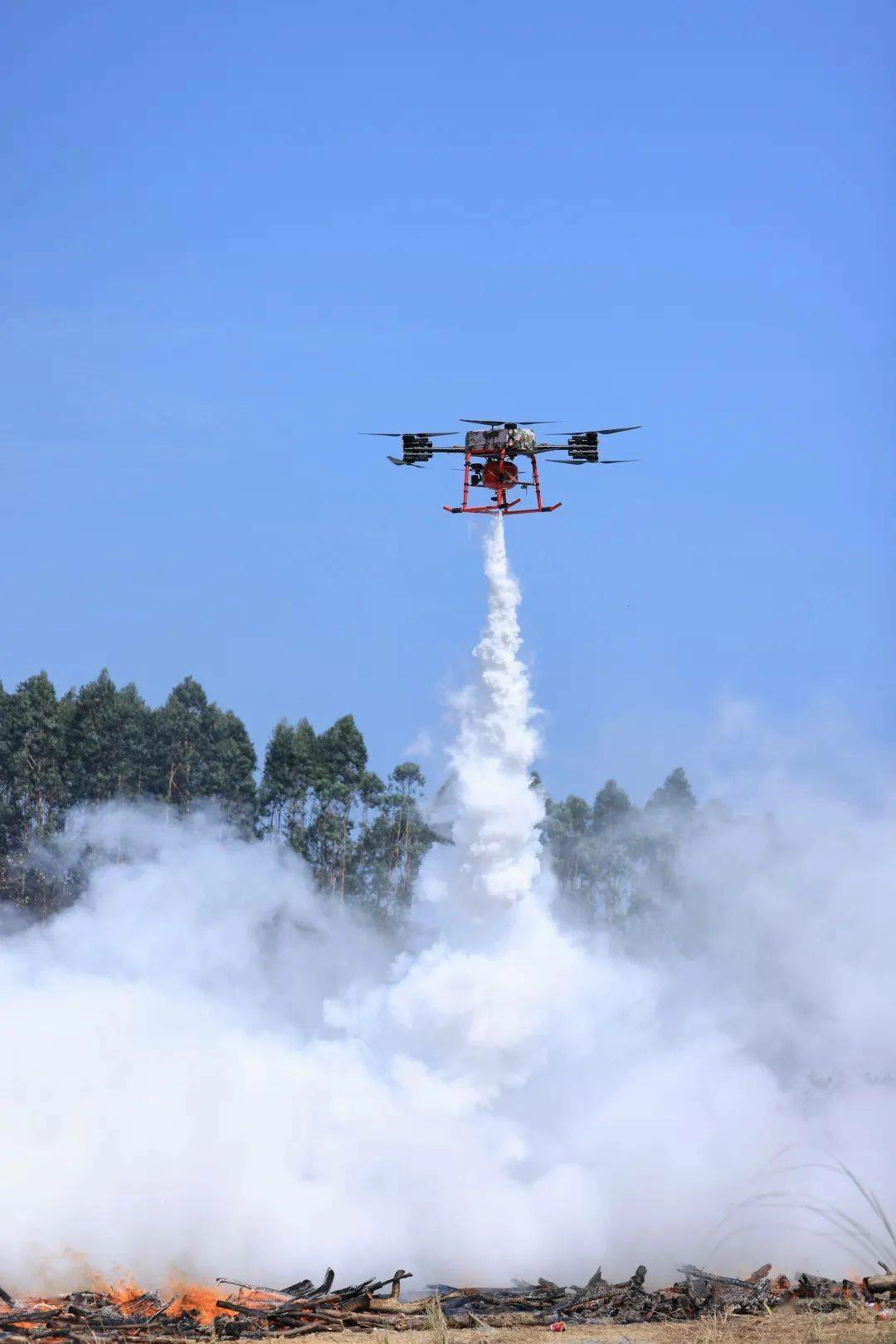
Heavy Support
High-payload platforms deliver tools, medical kits, and suppressant loads to remote crews or cut-off divisions without exposing responders to fireline hazards.
VANTA BOTICS Wildfire UAV

Thermal Mapping
High-resolution thermal sensors identify hotspots, spotting, and fire spread along ridges and drainages, giving command real-time behavior awareness.

Night Operations
UAVs maintain perimeter tracking through smoke and darkness, detecting overnight growth and residual heat when manned aircraft are grounded.

Heavy Logistics
100–300 kg platforms deliver tools, medical kits, and suppressant loads to isolated crews or cut-off divisions without exposing responders to fireline hazards.
Expand your wildfire capabilities with UAV systems built for thermal mapping, night IR coverage, and heavy-lift logistics. Strengthen fireline safety and maintain operational awareness when terrain, smoke, and distance limit ground access.
Aligned with Public Safety UAS Practice
VANTA BOTICS wildfire concepts are designed in line with recognized UAS practices used by wildland and public safety agencies, including:
UAS deployment approaches informed by U.S. Forest Service (USFS) and Department of the Interior (DOI) guidance
Integration with Incident Command System (ICS) structures for operations, division, and planning
UAS operational principles consistent with NFPA 2400 for public safety UAS programs, including airspace coordination, operational control, and data management
Discuss Your Wildfire UAV Needs
Wildfires demand more than line-of-sight decisions and occasional overflights. They require continuous intelligence, extended reach, and tools that keep firefighters out of unnecessary risk. If your agency is evaluating drones and wildfires as part of your response strategy, VANTA BOTICS can help you define:
- The right mix of thermal, optical, and communications payloads
- Long-endurance platforms for mapping and perimeter tracking
- Heavy-lift configurations (100–300 kg class) for rescue support and logistics
Tell us about your wildfire environment, fuel types, and operational challenges—our engineering team will help configure a UAV solution that fits your terrain, climate, and tactics.